Freezing rain fell on British Columbia's Fraser Valley Friday, shuttering schools for a third day and hampering travel after heavy snow rolled through the region earlier in the week.
Metro Vancouver schools, with the exception of Langley, reopened on Friday after two days off prompted by a storm Wednesday that dumped up to 38 centimetres of snow in southwestern B.C.
The B.C. Ministry of Transportation put up travel advisories through its DriveBC information system on Friday for a number of major arteries, including Highway 1 from Surrey to Hope, Highway 99 from Delta to the U.S. border and the Lougheed Highway from Mission to Hope.
The advisory said snow and freezing rain were possible on the routes, that conditions could rapidly deteriorate and there could be closures on short notice.
Freezing rain is also forecast to fall on the Coquihalla Highway into early Saturday, hampering travel between the Lower Mainland and the B.C. Interior.
"Surfaces such as highways, roads, walkways and parking lots may become icy and slippery," said the Environment Canada warning. "Be prepared to adjust your driving with changing road conditions."
Temperatures in the province have rebounded from the deep freeze earlier this month that saw daily record lows in several communities.
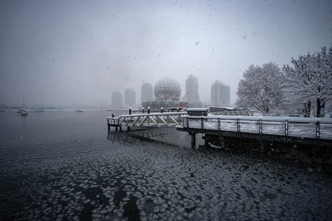
The cold snap was followed by a dump of snow that resulted in Vancouver's snowiest day in almost three decades on Wednesday with 28 centimetres recorded, cancelling flights and disrupting everything from mail service to transit.
Most weather warnings in southwestern B.C. were lifted Friday, but some snowfall and freezing rain warnings remained active along the province's central and north coast, as well as the northern Interior.
Across Canada, the extreme cold that had enveloped much of the Prairies in the last week has also shifted closer to seasonal temperatures, with only northern Alberta, around High Level, and Wood Buffalo National Park under a warning for wind chill values near -40 C.
Snow squall risks were also reduced in Central and Eastern Canada, with parts of southern Ontario, including Owen Sound, Sarnia and London as well as the cities of St. John's and Corner Brook, N.L., under active warnings Friday.
A smattering of winter storm and blizzard warnings covered parts of the North, including along the Labrador coast, in northern Quebec and the Yukon and Northwest Territories.
This report by The Canadian Press was first published Jan. 19, 2024.
The Canadian Press