As drivers negotiate the detours for work on Algonquin Boulevard under the Connecting Link project, we need to remember it is part of a main route — which qualified it for special funding.
This road serves as part of the main drag through the city, and has various names in each community within Timmins. But it is all connected as part of Highway 101.
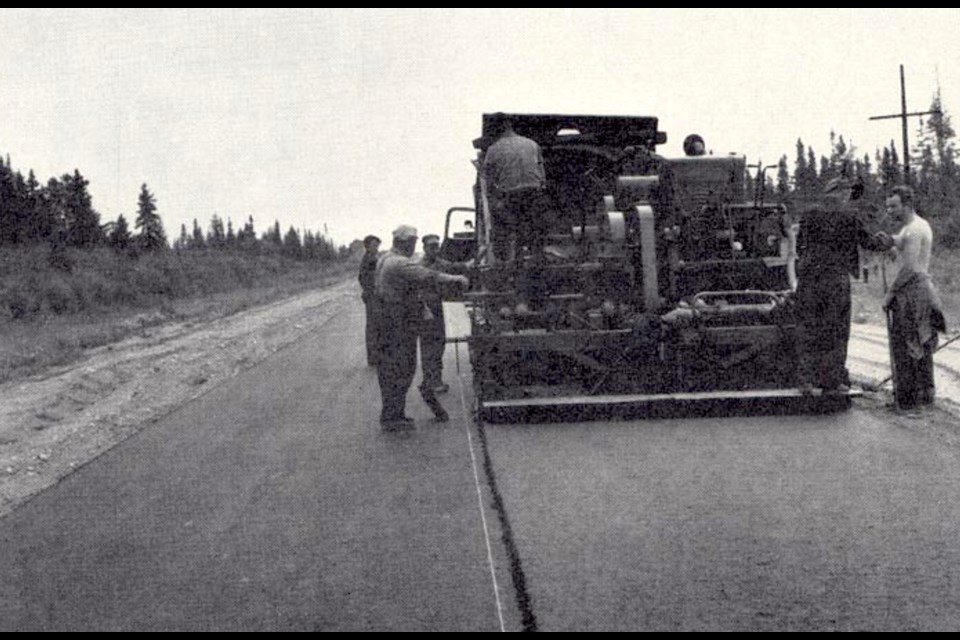
Highway 101, and funding for its maintenance, is part of the history of transportation in Ontario.
Look back to 1937, before The 101 was a glimmer in an engineer’s eye. The Northern Development Trunk Road, which connected Iroquois Falls and Timmins, was assumed as a provincial highway and was renamed King’s Highway 67. It served as the highway connection to Timmins and the Ferguson Highway, which is now known as Highway 11. The 70-kilometre highway was originally gravel, but part was paved later to provide better access to the Pamour Mine.
The Ontario Department of Highways wanted a more southerly connection with the Ferguson Highway. King’s Highway 67A served as a new cut-off route to the Timmins area. The Department of Highways constructed the road from 1938 to 1940 to provide a direct route from Matheson to Timmins, it was about 50 kilometres in length. A concession road between Hoyle and Matheson already existed, and was reconstructed to meet provincial standards.
Previously, drivers used Highway 67 to get from Highway 11 to Timmins, from Porquois Junction to near Hoyle.
As the highway was being planned, it drew a keen interest from The Porcupine Camp. In the Sept. 13, 1937, of The Porcupine Advance, a headline on the front screamed, in all caps, SOUTH PORCUPINE TO BE ON THE HIGHWAY.
“Mr. V. Evans (councillor) received a wire on Saturday afternoon that the Dept. of Highways officials have notified the engineers in charge of road construction to discontinue work on the highway cut-off, and the highway is now DEFINITELY to go through South Porcupine,” the story read.
“We have every reason to believe that this decision, which will be received with a great deal of satisfaction by South Porcupine business people, has been given by reason of direct action on the part of Mr. C. B. Gallagher, who got into the communication with the Dept. on Friday and insisted on action being taken regarding this question.”
No one wanted to be bypassed by the route and it was a hot topic.
“The Advance has been urging for several weeks past that South Porcupine be not sidetracked from the highway route as proposed by the engineers and some others who think of nothing but straight highways, forgetting that one of the vital purposes of roads in this North is to connect up existing towns and give transportation facilities to the industries of the country.”
On June 26, 1940, it was designated a provincial highway but was not numbered on provincial maps. It received the name Highway 67A and was renumbered Highway 101 in 1944.
Currently, the 473.3-kilometre Highway 101 connects Highway 17 west of Wawa with Highway 11 in Matheson before continuing east to the Ontario-Quebec border, where it becomes Route 388.
During the Second World War, plans were created to connect Timmins with the Quebec border and the route through Matheson was selected as the most direct path. It went from eastward to Abitibi, ending at Garrison Creek.
Locally, residents wanted to see upgrades on the highway.
According to a story in the Sept. 22, 1949, edition of The Advance, the business community advocated for making it a paved highway — upgrading from gravel.
“Members of the Porcupine Chamber of Commerce are prepared to present many fine resolutions that will greatly benefit this Northern Area when the organization gathers at the annual meeting of the Northern Ontario Associated Boards of Trade at Haileybury on Oct. 17,” the story read. “Be it resolved that whereas Highway No. 11 Kenogami to Wavell and No. 101 from Matheson to Pamour constitute the major arteries to the Porcupine area …. That this association strongly urge the Ontario Government to expedite the paving of these stretches of Highways at the earliest possible date.”
In 1960, the Trans-Canada Highway Act was passed.
The plan was to construct Highway 17 around Lake Superior, which took place over the next decade. The government wanted to create a road connecting Highway 11 with 17, so decided that Highway 101 would be extended.
The section of Highway 67 between Timmins and Hoyle was renumbered Highway 101 in 1955 and the route was extended west of Timmins to Warren Lake, and Highways 616 and 624 continued to the CNR stop in Foleyet. These all became part of Highway 101. Work also started to clear the Foleyet to Chapleau Resource Road for the highway. In 1960, Highways 616 and 625 were renumbered as part of Highway 101.
The link to Highway 17 at Wawa was completed in Canada’s centennial year of 1967.
Financing for maintenance of Connecting Link highways — stretches of provincial highways that run through municipalities and serve as major thoroughfares — dates back to 1927. Pieces of highways that were considered Connecting Links had maintenance funded by the province.
This Jan. 28, 1942, Advance story from a Timmins town council meeting showed that municipalities welcomed the program.
“The Department of Highway engineers who were in Timmins recently to look over the new Mattagami bridge had suggested to the town engineer that Fourth Avenue be declared a King’s Highway,” the story read. “The plan had been used in other centres and had worked out all right. They said that the Department of Highways would bear the expense of the upkeep of the street while the town would do the work on it.”
A 21.3-kilometre section of Highway 101 was transferred to the City of Timmins in 1997, as part of the province-wide downloading program of the Mike Harris government in Ontario.
Under Harris, the provincial government also reformed the municipal funding landscape in Ontario. Funding for boards of education used to come from local property taxes, while municipalities received more operational funding from the province. The government removed the lion’s share of school board funding from the property tax bill, but funding to municipalities was greatly reduced.
The downloading of provincial highways gave municipalities more infrastructure responsibilities with less provincial funding. Connecting Llink funding continued, but was reduced. Under future governments, the funding shrank and eventually became only available on an application basis.
Municipalities, reluctant to increase property taxes to keep up with rising costs of road maintenance, fell behind with the upkeep of their Connecting Links.
Under the current provincial government, the Ministry of Transportation has allocated nearly $74 million to Timmins for Connecting Link projects over eight years.