There were no new forest fires reported in the Northeast Region by late afternoon June 24.
At the time of the MNRF update, there is one wildland fire in the region.
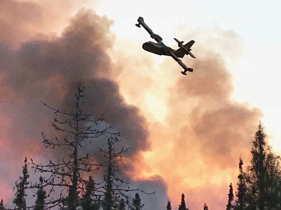
Timmins 2 covers 4,645 hectares and the fire is now being held. Crews continue to identify hot spots along the fire’s perimeter.
Ministry of Natural Resources and Forestry staff continue to work with the community of Gogama to aid community leaders and area residents.
At the time of the update, the fire hazard is mostly high across the Northeast Region, with a few areas north of Chapleau showing an extreme hazard.
Travel restrictions in parts of Timmins District due to forest fire imposed by MNRF Timmins District:
Pursuant to the Emergency Area Order signed June 11, an Implementation Order has been issued by the Ministry of Natural Resources and Forestry prohibiting access and travel in portions of Timmins District where there are public safety hazards as a result of fire activity from Timmins #002.
The Order restricts travel, access and use in an identified area (see map at Ontario.ca/forestfire) and may be modified regularly to reflect changing fire conditions.
This measure has been put in place to ensure public safety while allowing fire personnel to safely and effectively suppress the fires in the identified area.
All travel and use of Jack Road from the intersection of Jack Road and Highway 144, westerly to the Ontario Power Generation Mesomekenda Lake Dam, at Mesomekenda Lake is prohibited.
All use and occupation of Crown Land or within 500 metres of the described closed roads within this area is prohibited.
If a member of the public believes that access within the restricted travel area is necessary for non-recreational purposes, please call 705-235-1334 to request a travel authorization permit. MNRF will review the request for access based on the rationale provided, local fire activity, and the potential fire risk.
Please visit ontario.ca/forestfire to view the current access restrictions, associated map, and fire activity as this site is being updated regularly.
Help fight forest fires - stay clear of waterbombers
When waterbombers approach a body of water, move close to the shore so they can perform their scoop. A waterbomber will not scoop from a lake or river if encroaching watercraft pose a safety hazard.
More Information
For updates on highway closures, check Ontario511 or @OPPCommunicationsNER on Twitter, and Ontario Provincial Police-Northeast Region on Facebook.
For information about the current forest fire situation: 1-888-220-7242
For updates on the fire situation, visit ontario.ca/forestfire or follow on Twitter @ONforestfires.
To report a forest fire located north of the French and Mattawa rivers, please dial 310-FIRE
Sudbury.com


