WEATHER ALERT
ENVIRONMENT CANADA
**************************
3 p.m. alerts -
Severe thunderstorm warning in effect for:
- Timmins - Cochrane - Iroquois Falls
- Kirkland Lake - Englehart
- Temiskaming Shores - Temagami
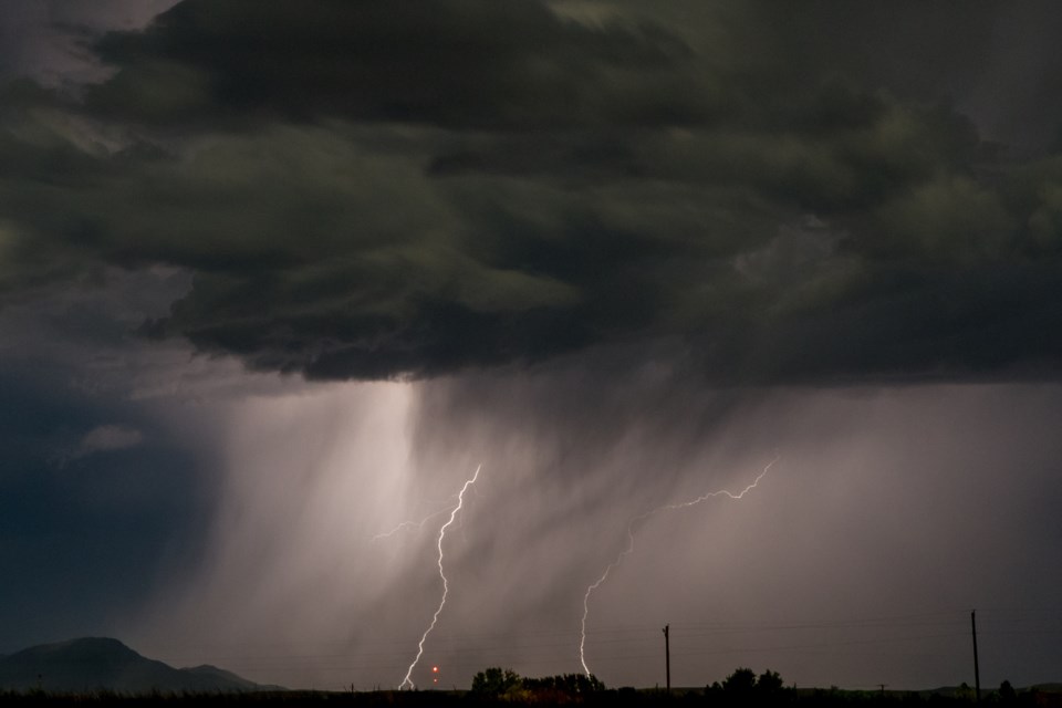
At 2:28 p.m. EDT, Environment Canada meteorologists are tracking a line of severe thunderstorms capable of producing very strong wind gusts, up to nickel size hail and heavy rain.
This line of severe thunderstorms is located from 25 kilometres south of Greenwater Provincial Park to 9 kilometres southwest of Iroquois Falls to 10 kilometres southwest of Kirkland Lake, moving northeast at 55 km/h.
Locations impacted include:
Kirkland Lake, Cochrane, Abitibi, Iroquois Falls, Matheson, Abitibi-De-Troyes Provincial Park, Esker Lakes Provincial Park, Potter, Tunis, Dunning, Monteith, Watabeag, Meyers Lake, Holtyre, Kirke, Bourkes and Howard Lake.
Take cover immediately, if threatening weather approaches. Heavy downpours can cause flash floods and water pooling on roads. Strong wind gusts can toss loose objects, damage weak buildings, break branches off trees and overturn large vehicles. Lightning kills and injures Canadians every year. Remember, when thunder roars, go indoors!
The Office of the Fire Marshal and Emergency Management recommends that you take cover immediately if threatening weather approaches.
Heat Warning in effect for:
- Little Abitibi - Kesagami Lake
- Timmins - Cochrane - Iroquois Falls
- Fraserdale - Pledger Lake
- Kapuskasing - Hearst - Smooth Rock Falls
- Kirkland Lake - Englehart
- Temiskaming Shores - Temagami
Humidex values reaching 36 are expected for the next day.
Heat event continues today.
Daytime high temperatures in the upper twenties to low thirties will accompany humidex values in the mid to upper thirties today. Overnight low temperatures in the upper teens to near 20 degrees Celsius are expected tonight. The heat event will come to an end as cooler temperatures arrive by Saturday.
Please refer to your public forecast for further details on expected temperatures.
Hot and humid air can also bring deteriorating air quality and can result in the Air Quality Health Index approaching the high-risk category.
Extreme heat affects everyone.
The risks are greater for young children, pregnant women, older adults, people with chronic illnesses and people working or exercising outdoors.
Never leave people or pets inside a parked vehicle.
Watch for the symptoms of heat illness: dizziness/fainting; nausea/vomiting; rapid breathing and heartbeat; extreme thirst; decreased urination with unusually dark urine.
Heat warnings are issued when very high temperature or humidity conditions are expected to pose an elevated risk of heat illnesses, such as heat stroke or heat exhaustion.
Please continue to monitor alerts and forecasts issued by Environment Canada. To report severe weather, send an email to [email protected] or tweet reports using #ONStorm.
12:55 alert - Severe thunderstorm watch in effect for:
- Little Abitibi - Kesagami Lake
- Timmins - Cochrane - Iroquois Falls
Conditions are favourable for the development of severe thunderstorms that may be capable of producing strong wind gusts, large hail and heavy rain.
These severe thunderstorms are forecast to develop this afternoon into this evening.
Lightning kills and injures Canadians every year. Remember, when thunder roars, go indoors!
Severe thunderstorm watches are issued when atmospheric conditions are favourable for the development of thunderstorms that could produce one or more of the following: large hail, damaging winds, torrential rainfall.
The Office of the Fire Marshal and Emergency Management recommends that you take cover immediately if threatening weather approaches.
Please continue to monitor alerts and forecasts issued by Environment Canada. To report severe weather, send an email to [email protected] or tweet reports using #ONStorm.
For more information: http://www.emergencymanagementontario.ca/english/beprepared/beprepared.html.
**************************


