A forest fire west of Timmins is still not under control and eight new forest fires were confirmed in the northeast today.
Travel restrictions are also now in place for a fire near White River that has grown to 6,810 hectares.
Timmins 6 that started yesterday (May 31) off of Malette Road is 8.5 hectares in size and not yet under control, says Aviation, Forest Fire and Emergency Services (AFFES) update for June 1.
It's located 13 kilometres west of Timmins and five kilometres north of Highway 101. Five FireRanger crews are working the fire with the help of aerial fire suppression.
Three new fires have been confirmed in the Cochrane area.
Cochrane 2 is 0.1 hectares in size and not under control. It's located about 7.5 kilometres southeast of Cochrane and 2.5 kilometres south of Highway 652.
Cochrane 3 is one hectare and not under control. It's located 18.5 kilometres south of Cochrane and 10 kilometres west of Highway 11.
Cochrane 4 is 0.2 hectares and not under control. It's about 13 kilometres south of Cochrane and 4.5 kilometres east of Highway 11.
"With regards to the Cochrane fires, which are located between Cochrane and Iroquois Falls, we are seeing heavy smoke and lots of fire activity. FireRanger crews are committed to these fires and waterbombers are attempting aerial suppression efforts," reads the AFFES update.
People with smoke-related concerns should call Ontario Health at 811 or 1-866-797-0007.
There are two new fires in the Kirkland Lake area.
Kirkland Lake 2 started May 31. It's two hectares and being held. It's located 13.5 kilometres west of Kirkland Lake and 2.5 kilometres northeast of Kenogami Lake.
Kirkland Lake 3 is 2 hectares and being held. It's located 28 kilometres northwest of the community and 1.3 kilometres east of Malloch. Lake.
"FireRanger crews are working on these fires, along with aerial suppression, and making good effort," says AFFES.
The other fires being reported are:
- Chapleau 2 is 0.1 hectares and not under control. It's about 6.3 kilometres southwest of Chapleau and one kilometre north of Earl Lake. One FireRanger crew is fighting it and have noted no issues.
- Chapleau 3 is 20 hectares and not under control. It's 72 kilometres east of Chapleau and 7.3 kilometres east of Garnet Lake. FireRangers are on site.
- Sudbury 5 started May 31. It's one hectare in size and reported as under control. It's located about 1.5 kilometres east of Clara Belle Lake.
Two fires continue to burn in the White River area.
Wawa 2, which started May 26, is not under control at 105 hectares.
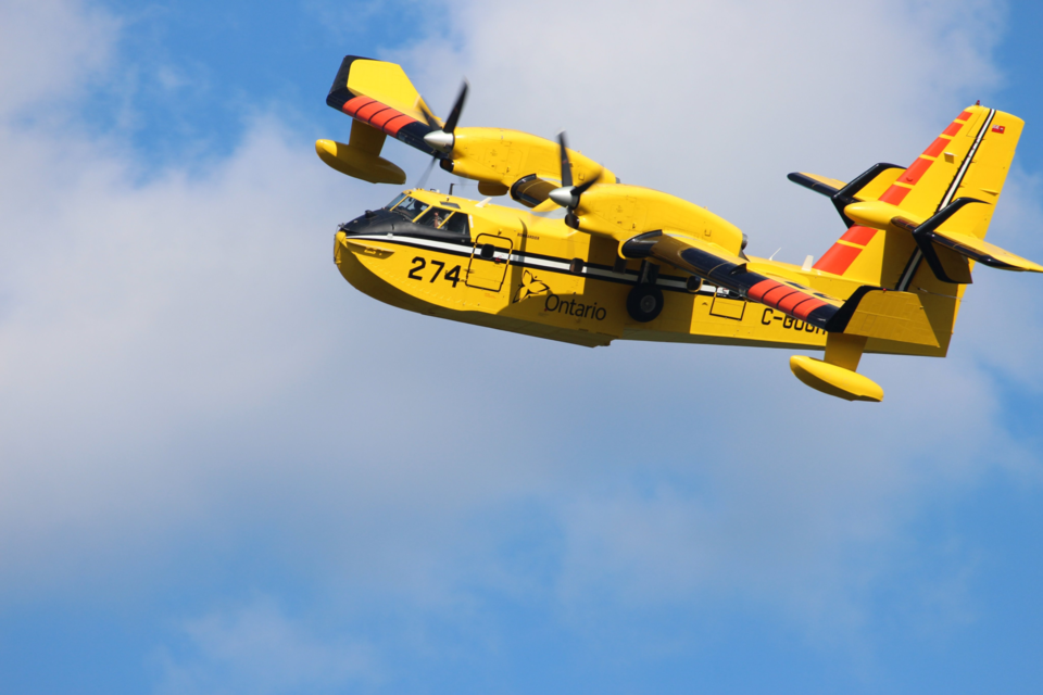
Wawa 3 is 6,810 hectares and still not under control. It's located about nine kilometres southeast of White River and on Highway 17 near the Depew River. There are five helicopters and 12 FireRanger crews assigned to the fire and additional resources have been requested, says the AFFES. Crews have also been fighting the fire from the air and structural protection is ongoing.
Because of the fires, there are travel and use restrictions in the Chapleau-Wawa district.
The travel and use of the following areas are prohibited unless you have a travel permit issued by the Chapleau-Wawa District Ministry of Natural Resources and Forestry:
- 400 south of where Road 400 intersects the White River Forest Unit boundary
- Road 300 south of the intersection of Road 300 and Road 350
- Road 500 west of the intersection of Road 500 and Road 550
- Road 226 west of the intersection of Road 226 and Highway 631
- Mink Lake East Road north of intersection of Mink Lake East Road and Highway 631
- Mink Lake Boat Launch Road north of intersection of Mink Lake Boat Launch Road and Highway 631
- Operational Road 631-02 north of intersection of Road 631-02 and Highway 631
- Operational Road 631-01 (aka. Tower Road) north of intersection of Road 631-01 and Highway 631
- Road 100 north of intersection of Road 100 and the Picnic Lake Road
- North Reagan Road north of intersection of North Reagan Road and Road 50
If you require a travel permit, call 705-856-2396.
For information on lost structures, call District Information Officer Tim Mutter at 705-864-3139.
Due to the extreme forest fire hazard, a restricted fire zone is in effect for the northeast region. The Ministry of Natural Resorces declaration went into effect Thursday, June 1 at 12:01 a.m.
Yesterday, a fire ban was also issued by the City of Timmins.


